So on the 26th April 2011 I left Romford and travelled to Victoria Coach Station London for a 13 and a half hour trip to Inverness via Manchester,Preston,Glasgow,Perth,Aviemore on a Megabus Coach.
We arrived at Manchester, where we were told we could get off for 15 minutes.Ash and I got off and I grabbed a coffee and bag of crisps from the coach station shop, as we came out we saw our coach driving off!..... I thought its only been 5 minutes, the thought off being stranded in Manchester while the coach drove away with all our gear scared the hell out of me!! I threw my coffee in the air and sprinted off after the coach. I caught it up on the corner and the driver indicated he was driving round the block and was pulling up again. Relief and all that running for nothing plus no coffee :( lol. was a funny moment afterwards though.
We changed coaches at Perth and made our way through the Cairngorm National Park as the sun set.
We eventually arrived at Inverness Bus station at 2145 hours, where we then walked a couple of miles to Inverness SYHA where we had a bed for the night.
At 0530 hours the next morning on the 27th April 2011 we made our way back to Inverness Bus station to get the Citylink bus 919 to Fort William to climb Ben Nevis.
The bus took a lovely route through Inverness on its 1 hour 50 minute journey.
and along Loch Ness,
Arquhart Castle on the loch where the most sightings of the Loch Ness monster are made,
The bus then travelled through Fort Augustus and then towards Fort William where we got our first view of Ben Nevis from the bus.
We arrived in Fort William and popped over the McDonald's for Breakfast before walking the two miles to Glen Nevis and the visitor centre where the path up Ben Nevis tourist path starts.
We crossed a bouncy bridge that had a sign saying "no more than 5 people on the bridge at a time" over the River Nevis.
| From | To | Distance (m) | Ascent (ft) | Descent (ft) |
|---|---|---|---|---|
| Ben Nevis Visitor's Centre | Ben Nevis summit | 5.0 | 4478 | 118 |
| Ben Nevis summit | Ben Nevis Visitor's Center | 5.0 | 118 | 4478 |
| Ben Nevis Visitor's Centre | Fort William Railway Station | 1.8 | 131 | 167 |
and then onto the path up, it was coldish as we first started and we were wearing our coats, but these soon came off as we warmed up with the walk.
The track continues to rise as it skirts the western side of Meall an t-Suidhe, zigzagging twice and crossing a couple of streams by means of a couple of small metal bridges to reach 350 metres above sea level. The track then starts to veer northwards, following the western bank of the Red Burn Gully. Another, larger zigzag takes you up to the saddle between Ben Nevis to the east and Meall ant-Suidhe to the west at 570 metres above sea level.
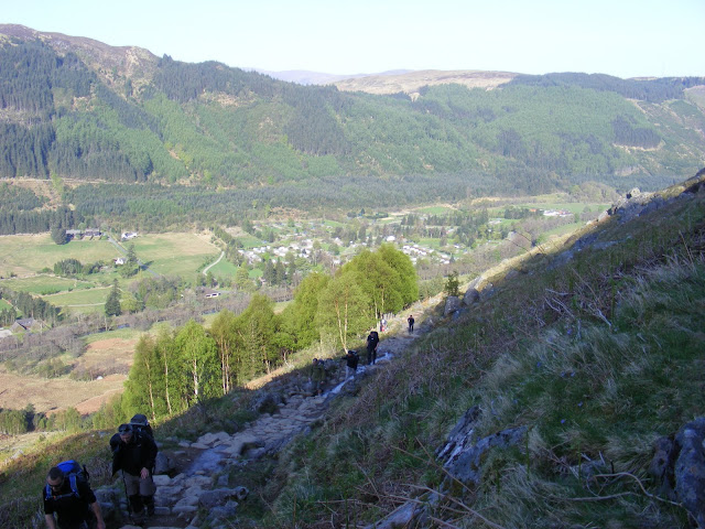
The route started quite steeply and climbed up until we came to a view down to a loch.
The track passes to the east of Lochan Meall an t-Suidhe that lies in the saddle. It then turns to the right to start the ascent up the western side of Ben Nevis. At NN 1473 7186 the track crosses the Red Burn under a waterfall, and this marks the halfway point of the ascent, at 600 metres above sea level.
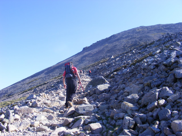
From the Red Burn the track continues up the north-western shoulder of Ben Nevis in a series of four giant zigzags. These bring you out at the 1,200-metre level, and the gradient of the track starts to flatten out as it heads in a westwards direction. One last, but thankfully short, ascent of McLean's Steep leads to the summit plateau. Across here careful navigation is needed to reach the summit cairn at 1,344 metres above sea level.
Ash doing a snow angel, he hadn't fallen over (honest lol)
Then some hard slippery walking across some icy snow towards the summit.
THE SUMMIT
The summit plateau is bounded on the north-eastern side by some very steep drops, including Tower Gully and Gardyloo Gully, which the path runs adjacent to. Be careful to avoid these gullies, particularly in winter when cornices may have formed over the edge.
We reached the summit in 3 hours and 10 minutes, Quite happy with that time,mainly due to Ash frog marching ahead of me!!
Memorial plaque at the summit.
On the summit is the remains of the old meteorological station, built by Public subscription and opened on the 17th of October 1883. It was manned throughout the year by a superintendent and two assistants and provided meteorological observations every hour for 20 years. It is now ruined, but enough remains to make you admire the hardy people for whom this was home. It finally closed on October 1st 1904 after the funds to run it ran out, and over the years it slowly fell into disrepair.
I found a quick way down, only cut short as it was so bumpy that I can to a standstill lol.
We made it down in 2 hours 10 minutes, it was very hard going as the stony rocky ground was pounding our feet as our toes were forced forward into our boots. I actually thought going down was harder than the ascent.We finally reached the bottom for a well earned pint and packet of crisps in the Ben Nevis Inn.
This makes a total distance of 13.5 miles, with 4763 feet of ascent and 4763 feet of descent.
After that we walked the two miles back into Fort William, bought some gifts and I had a cup of tea,jacket potato followed by a gorgeous Waffle and vanilla ice cream and maple syrup Mm-mm.
Then we boarded the 919 bus back to Inverness following the same route as we took in.
Fort William picture above
Inverness castle pictured above.
Then a two mile back to the SYHA for a shower and a change of clothes. Then we walked back into Inverness for a couple of pints in The Exchange Public house and watched the Champion league game Real Madrid v Barcelona and then some chips and a Scottish delicacy a Battered Mars Bar!
After a few hours sleep we were back up at 6am to catch the 0710 hours coach back to London.
Finally walked indoors at 10pm,knackered but what a great experience!


.JPG)
